For big occasions, like the harvest, I like to capture the moment through different media to express it in different ways. My DJI drones do a great job at this with being able to capture the moment from above or like on a crane to get angles just out of reach. I want to try to capture the moment and feeling I get at that time. Sometimes it is just on the ground. Other times through the air. Please see below for the blog about farming.
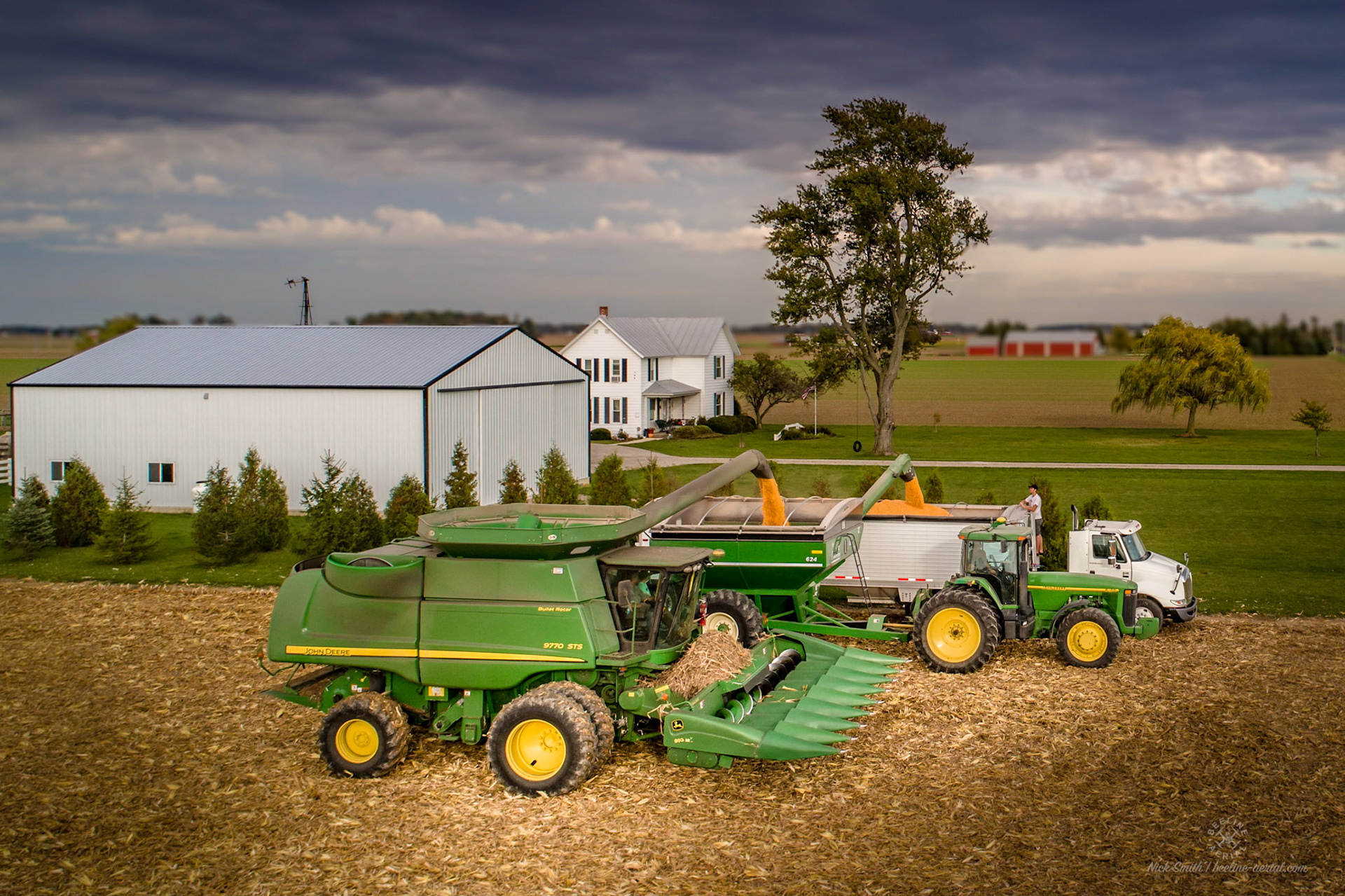
Farming is such a joy to me. It is hard work, with long hours, for everyone involved. From my experience with my wife’s family, it is usually an effort completed with the help of family and friends. I have helped over the years with hauling grain to the elevator and chisel plowing the fields to get ready for the next season. The farmers around where my father-in-lay farmed are definitely one big community. Often, other farmers will come and help out when their own fields are finished. Sometimes it is just to run a truck or wagon to the elevator to keep things moving.
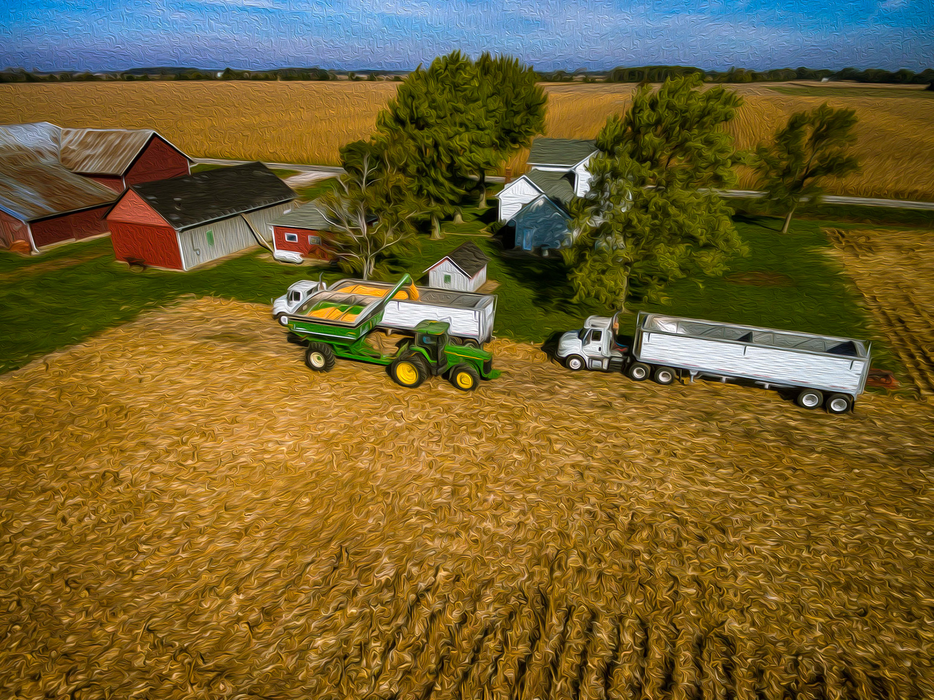
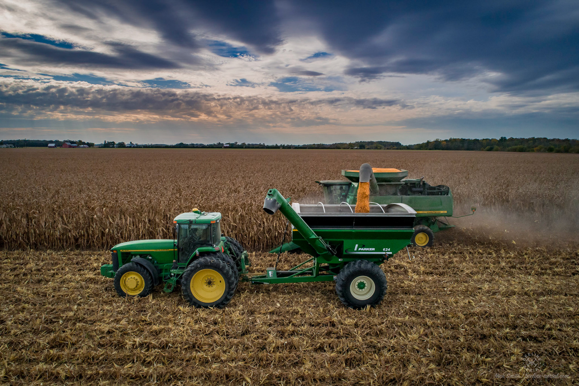
I try to depict my feelings about farming in the photos that I take of the farming process. The photos we would take around the farm with the camera always had one or more of us running some piece of equipment or the kids sitting with Papa Mike in the combine, tractor, or truck as he worked. The scale of everything from the ground always seemed large.
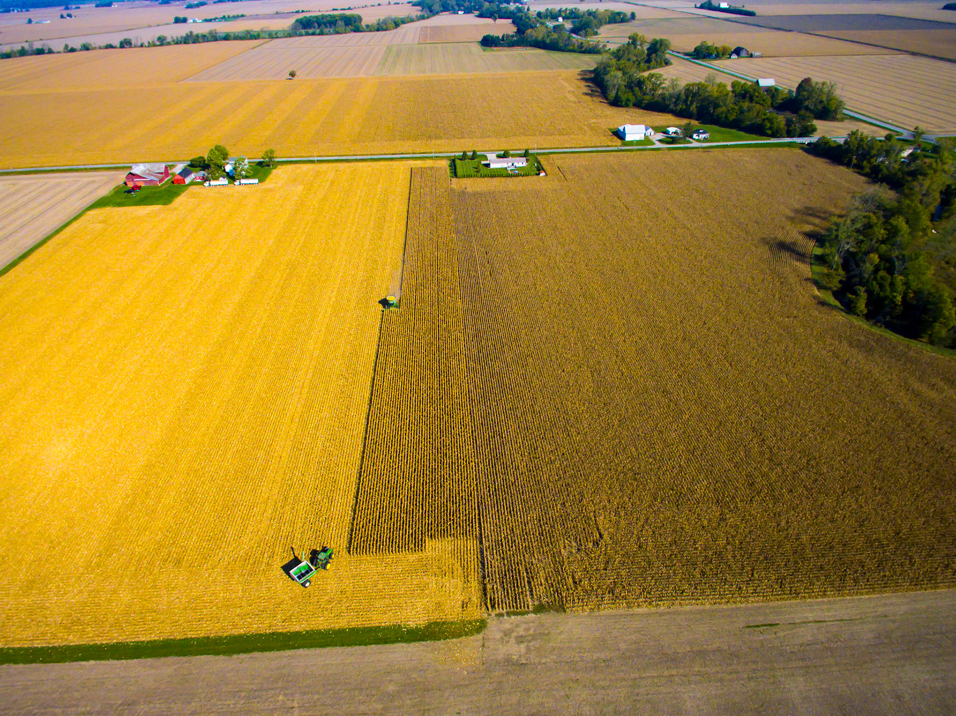
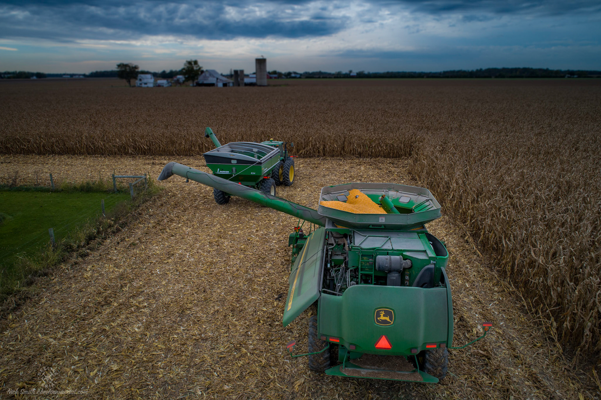
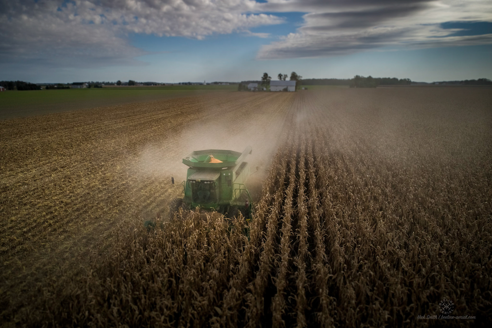
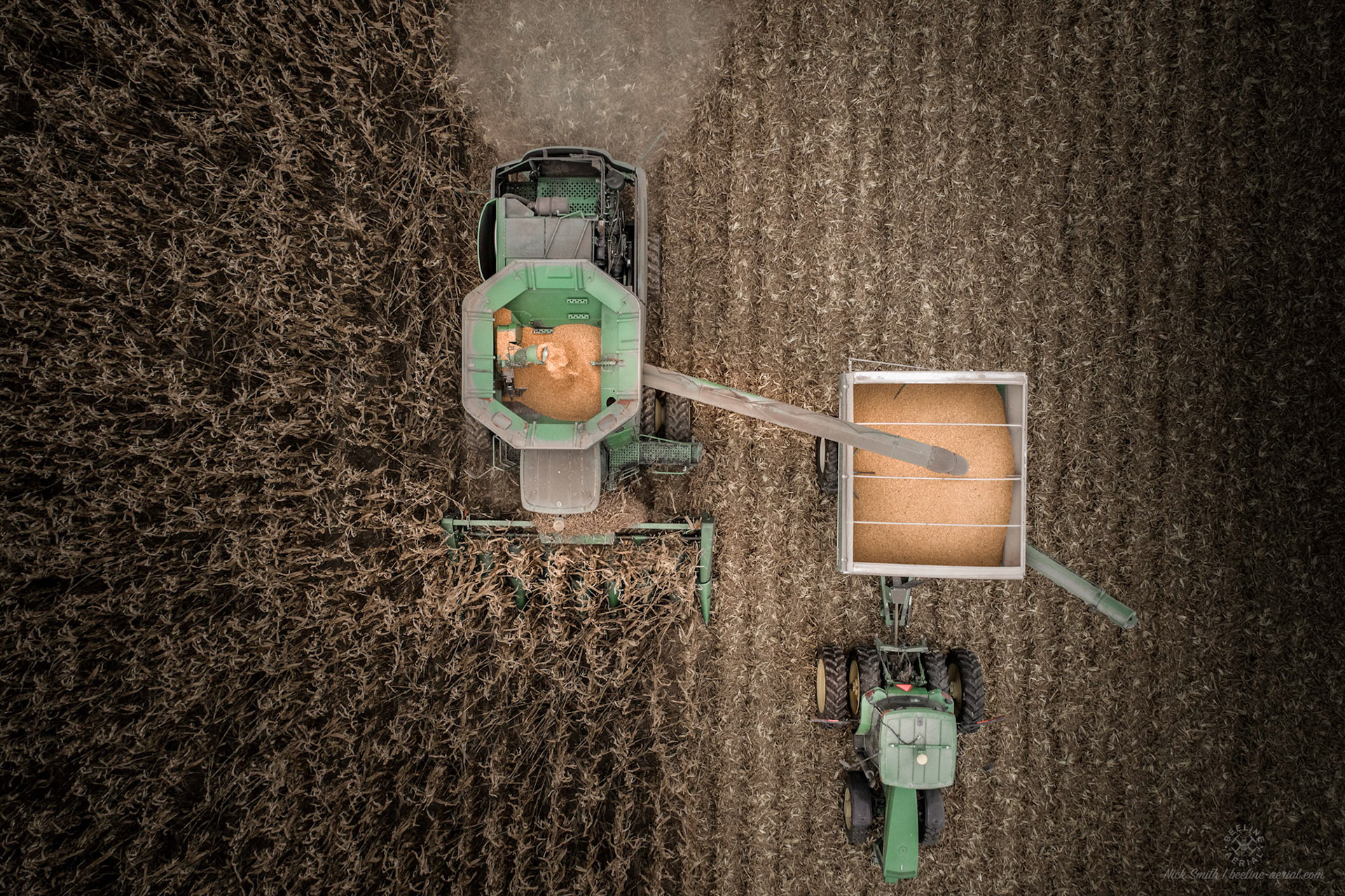
When I obtained my 1st drone, my view of the farm and farming totally changed. It was not only large equipment, but everything was on a large scale. You could see the scale of everything even more in the air. Looking back, it was, and still is, hard to grasp just how vast everything is from the equipment, to the size and amount of fields and crops. You can only see a few rows in to the field of corn when it is growing. Soy beans and wheat you can see over, but still with a limited view from the ground. Aerial photography with drones has helped immensely with being able to see over the crops. The combine and tractor look so small at the opposite end of the field when seen finally in the air. Plus, it is a great way to see how the equipment is running when in use in the fields. Things like dust trails from the combine, grain going into a wagon from the combine auger, and sending everything to the elevator by truck are so exciting! Farming is also my favorite rural item to video. You can show how everyone works together to do the work and get it done.
Being able to use aerial photography, video, and mapping is very important to me to help with farming for the whole community. It lets me still be a part of the process, even though my father-in-law has retired from the day to day operations of farming. You have to be a commercial drone pilot, which I am, to do aerial work with drones for farming. It is considered a commercial use under the FAA. This will be discussed more in future blogs.
Now, I can still help in a totally different way by using my drones for aerial work. They can be used to fly over a field to check spots to make sure the crops are growing. With mapping software like DroneDeploy, you can even make highly detailed maps to check the crops, plant health, spots that sit in water, etc. A commercial drone pilot can do video of a field or live stream the video to the farmer over YouTube, Facebook, or other platforms directly from the drone. I have done this with success in the past.
I feel my greatest accomplishment to date with using my drones in this capacity was when my father-in-law asked me to check a field. There was an area of the field where the soybeans were not growing. Water had pooled in the area after some spring rains. He wanted to make sure the field tile was still functioning. I did a flight of the 30 acre field with DroneDeploy to make an aerial map like you may see from the county. I uploaded the images to the DroneDeploy server for processing. It was done in less than 12 hours. (Note: now, while you are flying, you can get lower resolution mapping in real time with the software.) We could not believe what it showed us! It was very evident that a piece of tile was not functioning. You could see with great detail that the main tile to the back ditch had collapsed or was not functioning in the middle of the back part of the field. You would never have been able to see this on the ground. It would have taken hours, if not days to figure it out. After we saw the broken tile, it saved my father-in-law money! The map showed that it was just a portion of the field that needed to be retiled, not the whole field. For a farmer, any little savings is big! I was very excited to help out and to use my skills with my drones to be part of the farming process.
I could go on for pages and pages about all of the great things that drones have done, continue to do, and will do in the future for the farming process. There are many different ways drones are already being used. I have just scratched the surface with how and why I love them for farming. I am going to end a little different with this blog because of all I can share about this topic. I would love to share more of my experience with you all on this on a personal level, not to promote what I can do, but more to show you personally how it can benefit you, a family member, or a friend that farms. This is not only good for crops but also farmers dealing with livestock. I am excited to have you all part of my blogging and photography experience. I look forward to sharing more with you all!
COMMENTS
SHARE A COMMENT
Thank you for you comment. I look forward to reading it and sharing as specified.