Aerial mapping via drone is a fast upcoming market. Aerial mapping via drone can give real time data with better detail than satellite, Google, and even County GIS data. Why? Aerial mapping via drone can get much lower to the ground than a conventional aircraft. Most uses for this type of work will have the drone be above treetop usually less than 200 feet.
Software used to make aerial maps for clients is done using a third party service provider, DroneDeploy. This online software is great for me as well as clients because the client can get the data in a matter of hours. Plus, this company also has the ability with the software for me to share the data directly to the client via their website or app so the client doesn't have to spend more money to view the resulting maps themselves. This is a must need for construction site superintendents, farmers, inspections, insurances, developers for commercial and residential sites, etc. The data you can obtain can help make decisions quickly for dirt and gravel volumes at job sites, field tiles broken in need of fixing, field spot spraying for farmers, crop health to determine reseeding or fertilizing needs of crops, damaged roof areas for insurance purposes, as well as many other uses.
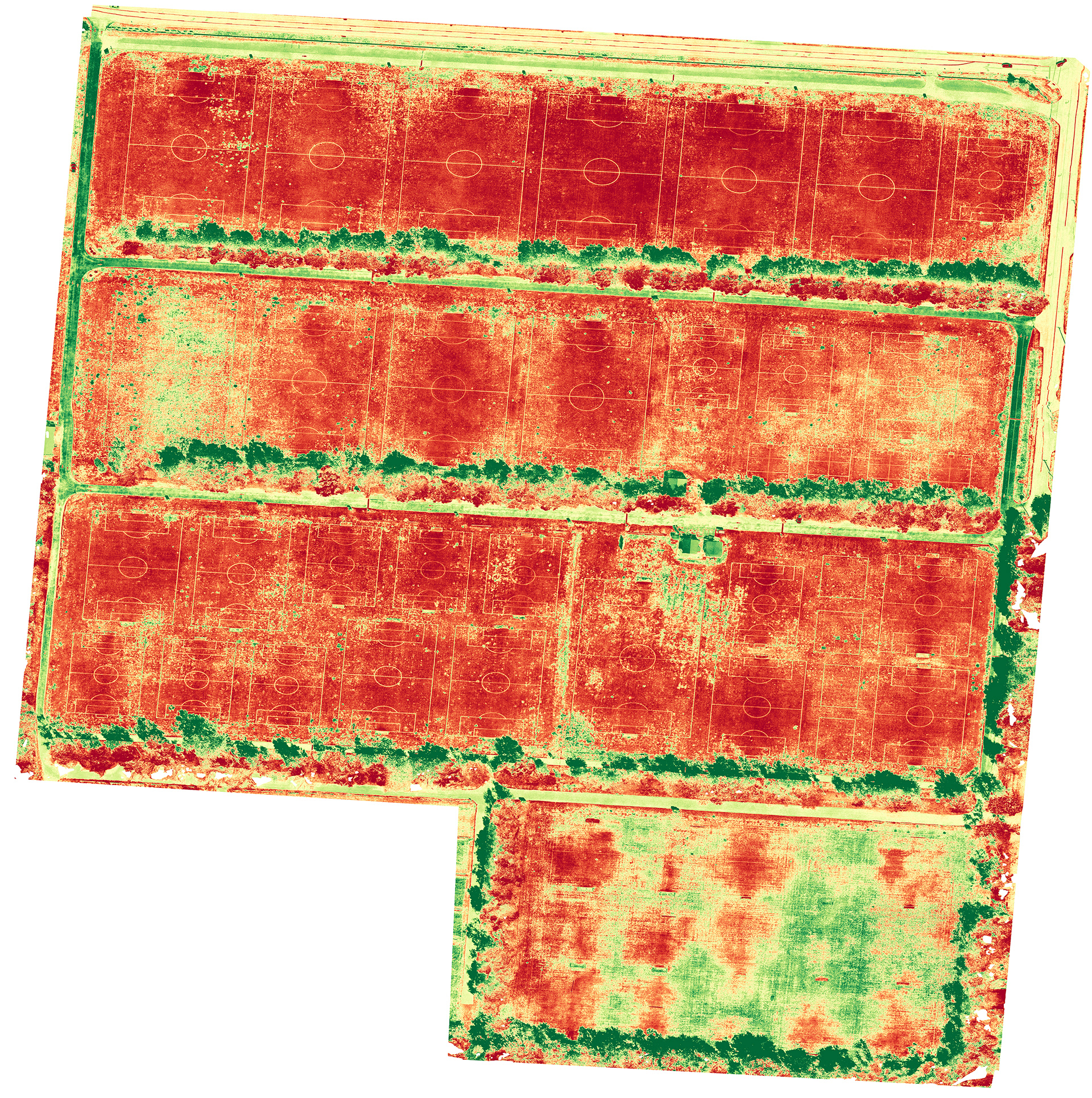
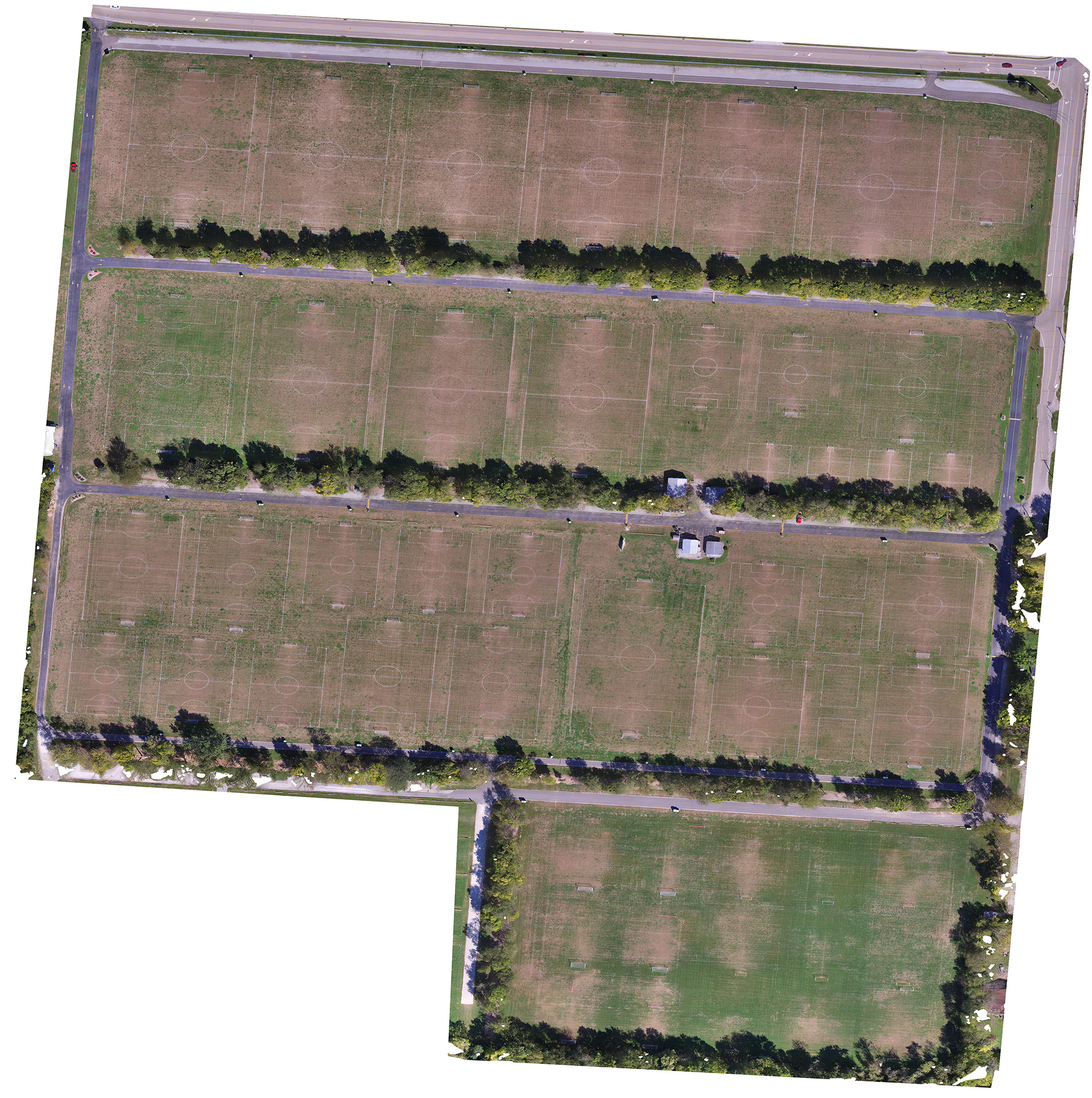
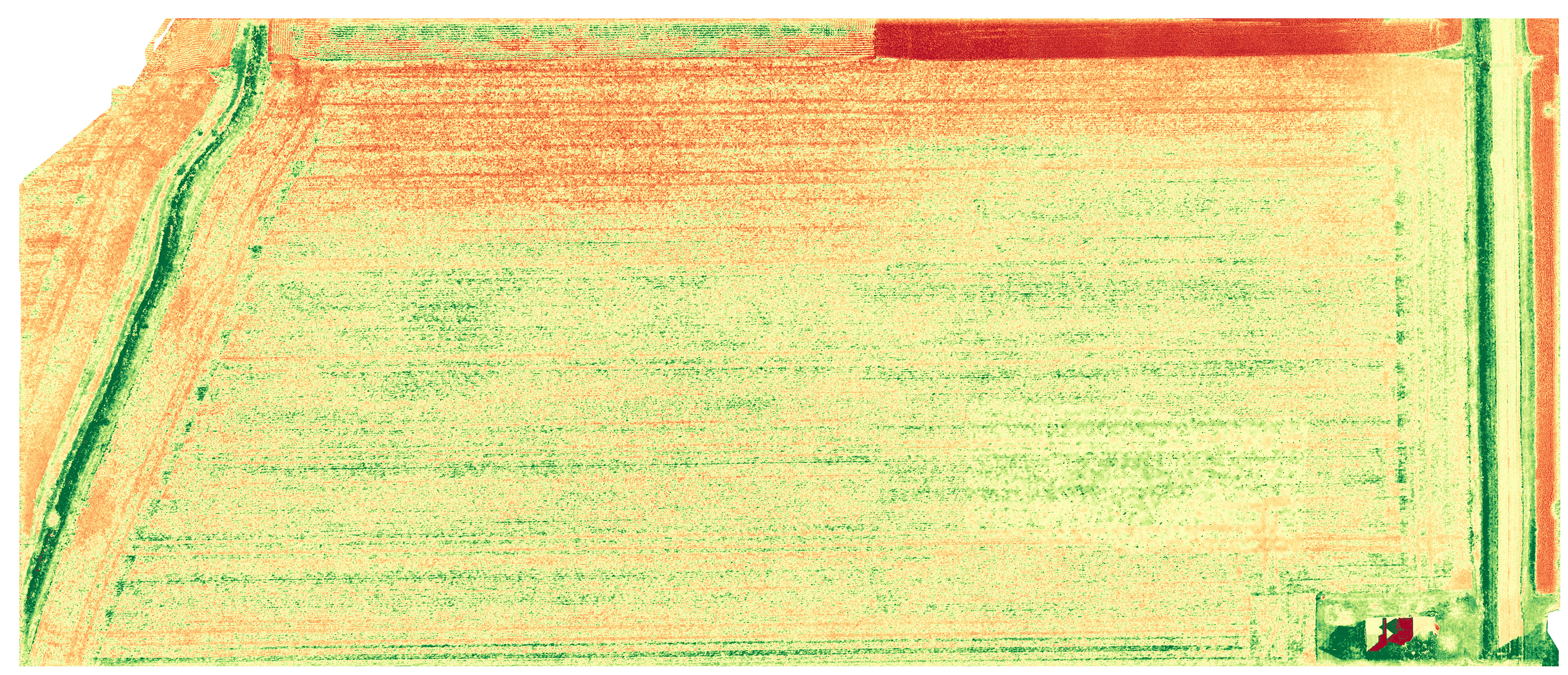
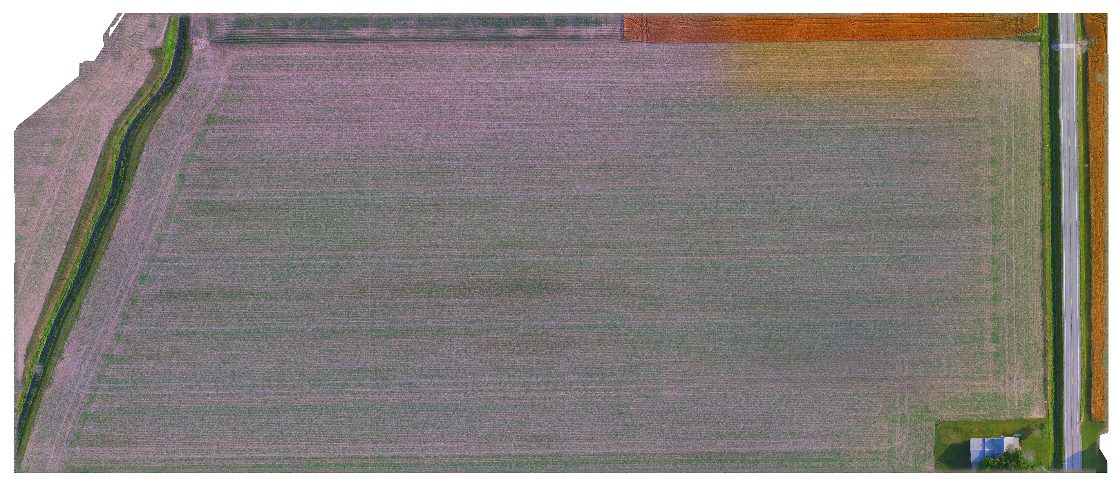
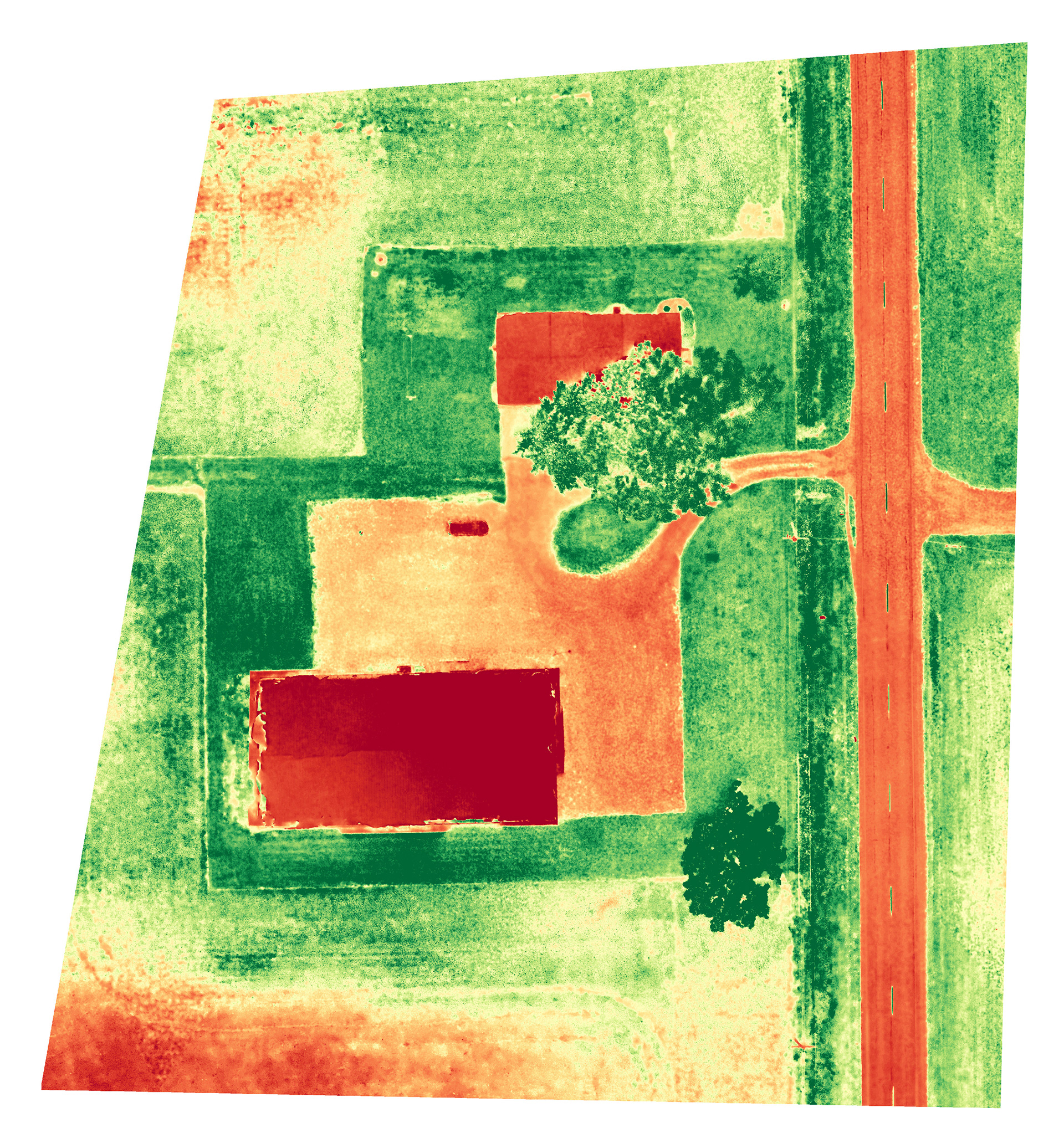
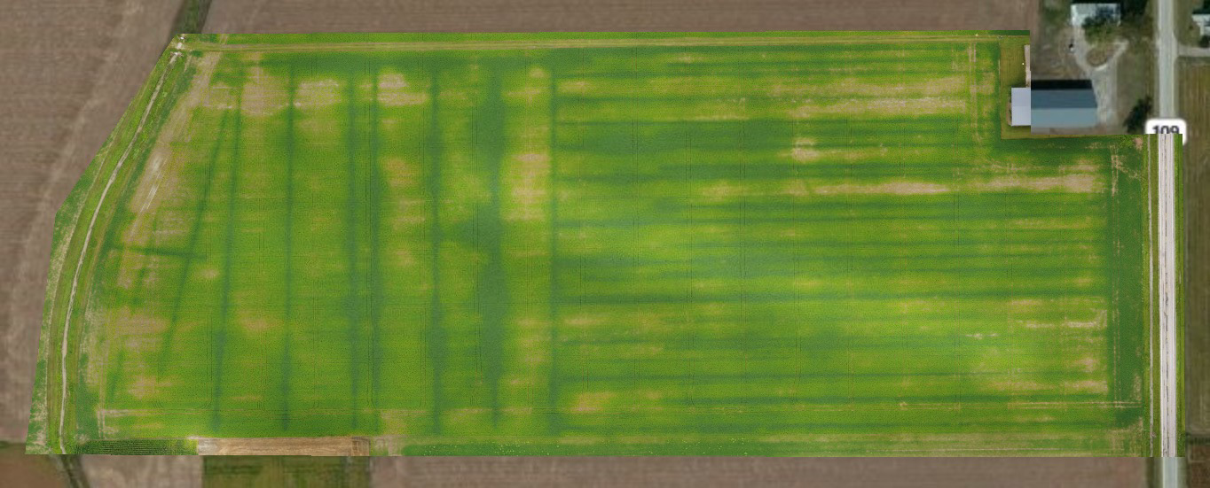
Below is a collection of aerial and NDVI style maps made through DroneDeploy for people and organizations to help determine plant health and growth, field tile issues, and redoing field tile for farmers. These were completed with the stock camera on the DJI Phantom 3 Standard and Phantom 4 Pro. NDVI style maps were produced with DroneDeploy with their conversion algorithms converting the orthophotos taken with the drone to the NDVI style maps. The DroneDeploy software produces these style maps by applying their various algorithms and filters from the othophoto produced. This is great for farmers and other groups to help them give them a visual how plants are thriving or identify areas in need attention and to help with their plan to address areas in need of attention. These maps also can be produced for elevation or 3D to show the variations in elevation for ground and plants for the area mapped.
Note: As can be seen with the various maps, the NDVI style maps need to be used in conjunction with the orthophoto to determine how the colors produced correspond to what is actually in the photo since these are taken from conversions of the orthophoto and not taken from a true NDVI camera.
For information on pricing, please see the aerial photography pricing page.